|
|||||


|
|
|
|||
|
|
|
|
|||
|
Français |
|
||||
|
Italiano |
|
||||
|
Español |
|
||||
|
Deutsch |
|
||||
|
|
|
||||
|
|
|
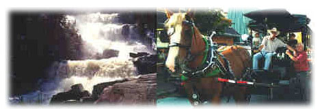
Lodging |
Restaurants |
Directories |
Airport |
|
|
|
Page |
Ste-Agathe |
Mt-Tremblant |
St-Jovite |
|
|
|||||
|
|
|
|
|||
|
|
|
|
|||
|
Français |
|
||||
|
Italiano |
|
||||
|
Español |
|
||||
|
Deutsch |
|
||||
|
|
|
||||
|
|
|
Lodging |
Restaurants |
Directories |
Airport |
|
|
|
Page |
Ste-Agathe |
Mt-Tremblant |
St-Jovite |
|
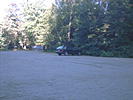
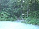
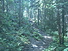
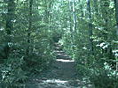
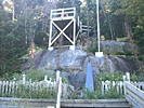
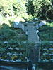
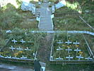
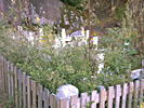
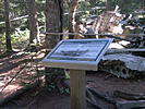
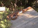
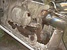
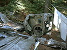
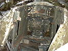
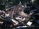
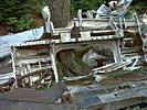
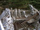
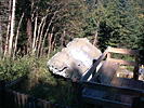
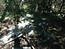
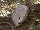
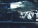
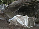
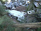
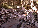
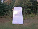
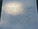
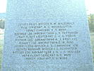
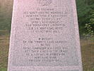
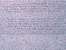
Warning: This page is for information purpose only and cannot be taken as a motive to make the hike. This page is only to share a virtual hiking trail. If you decide to visit the hiking trail, you will have to take the full responsability of any event or accident, as for any typical hiking trail in the woods. The owner of the present site cannot be held responsible for any accident or mishap happening during the course of such activities. The accident that cost the lives of 20 military airmen, on October 19th 1943, has been the worst accident in the history of canadian military aviation. In a major snowstorm, the plane crashed on a cliff near the top of the Black mountain and pieces of the aircraft were spread in the nearby forest. You will find here some pictures that show all the horror of the drama. The site has been properly set up recently, before the commemorative ceremonies. If you visit the site, take the time to think of all the horrors of war, and hope that your children will never have to participate. Those people have given their life for the defence of our country, even if they didn't die on the front line. They were coming back from Europe for a permission and this was their last trip. Those people have earned our recognition forever. A descendant of one of these officers, Eric Morgan Finn, has written me recently and told me that each generation of their family give a name in relation to this officer to one of their children. The trail is easy and wide and doesn't have major irregularity in the landscape. The hike takes 3 hours to go up, so bring good shoes. As the altitude is high, bring more clothing in case of a temperature change, and lot's of water... The entrance of the trail is located on Chemin Régimbald and the panels indicate "sentier inter-centre". The parking can accommodate dozens of well parked cars. Take the time to look at the pictures following and see also the panorama. Please note that I asked the Canadian Armed Forces to change the flag (they did answer and will take care of it). A joker has made a really bad joke. I will change the panorama as soon as I will redo the trail. Here is the course: you can also look at the Liberator in 3D VRML format, just click here. You will probably need to install the Cosmo Player plugin at: http://www.cai.com/cosmo/ To see the course in 3D VRML format, click here. 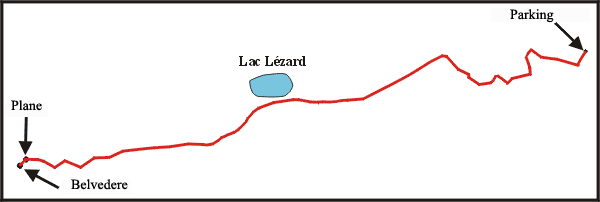 Here are the coordinates according to the GPS: Entrance and parking:
|
|||||||||||||||||||||||||||||||||||||||||||||||||||||||||||||||||||||||||||||||||||||||||||||||||||||||||||||||||||||||||||||||||
|
All rights reserved |